
Instrument Expert
Original factory packaging

Service Hotline:
(+86)010-52867771
Instrument Expert
Original factory packaging
Service Hotline:
(+86)010-52867771
Updated:2025-03-13
Views:2415
 WeChat
 QQ
QQ
 Online Service
 Product Manual
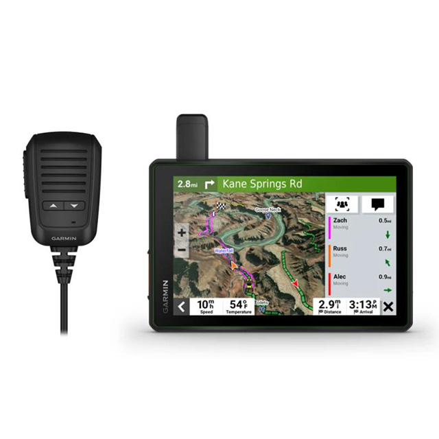
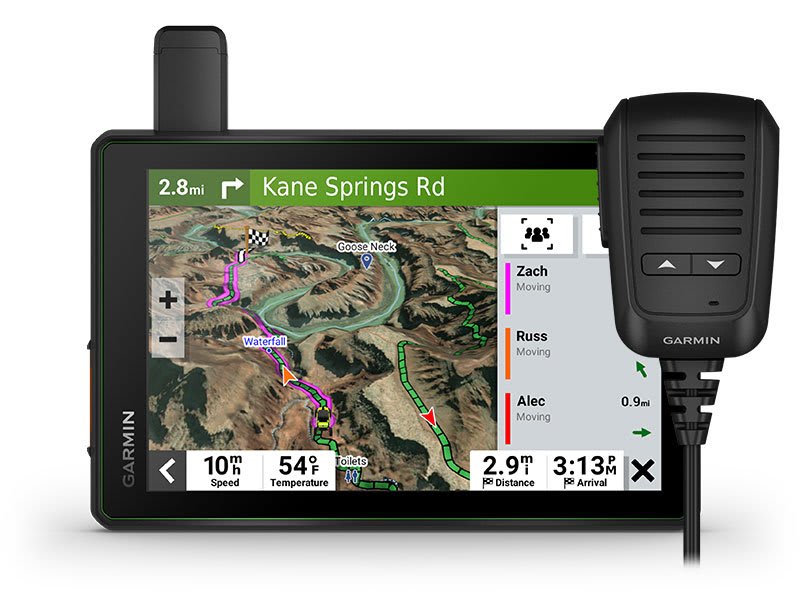
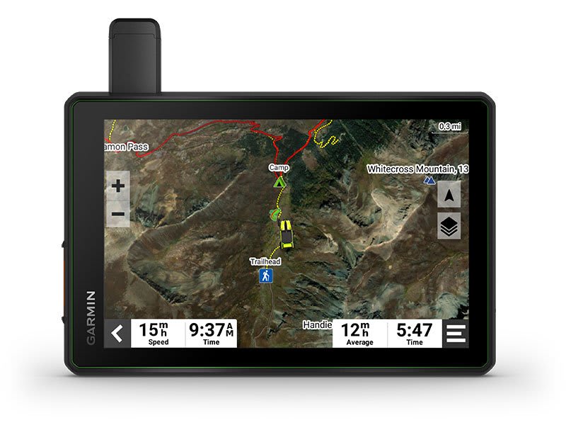
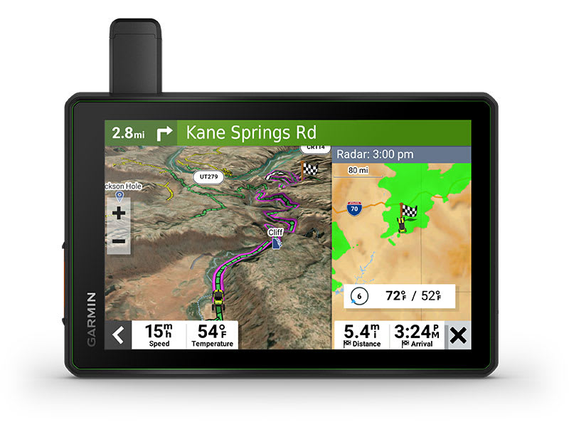
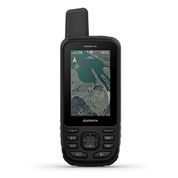
Hit the trails and have fun with your friends with this rugged powersport GPS navigator. It has all the mapping you need to stay on track and communication technology to stay in touch while you’re out there.
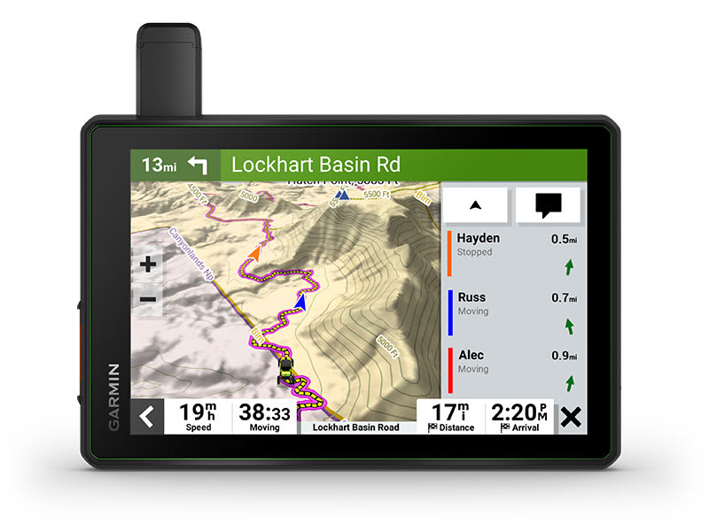
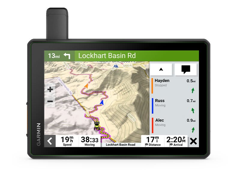
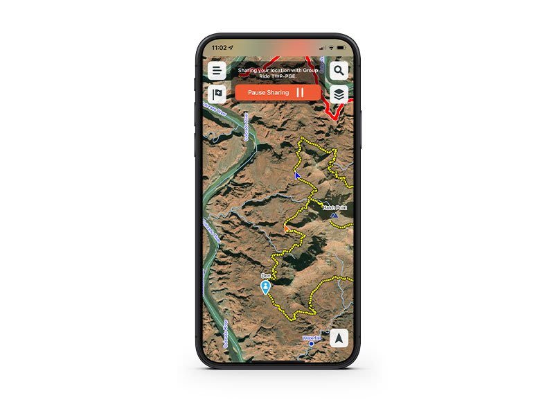
Keep your crew together with group tracking for up to 20 riders, plus push-to-talk fist mic.
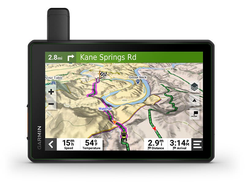
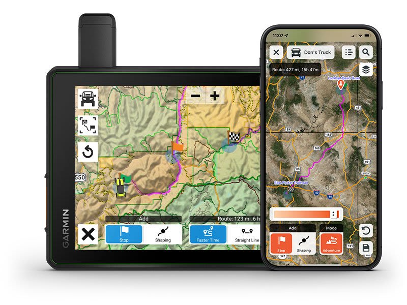
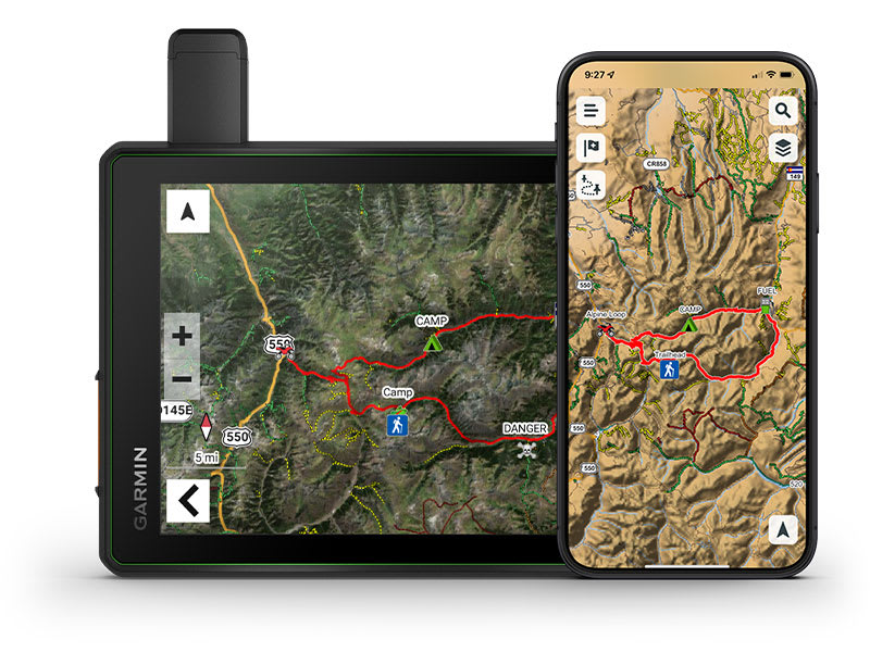
Navigate unpaved roads and trails by using turn-by-turn trail navigation1 with OpenStreetMap (OSM) and USFS Motor Vehicle Use Maps.
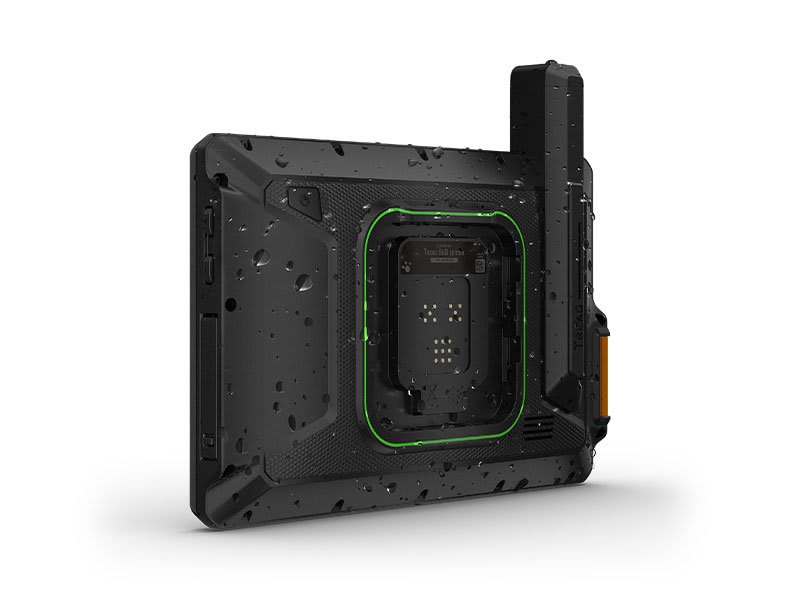
This rugged navigator is IP67 weather-resistant and has a glove-friendly 8” touchscreen display.
See vivid aerial views of terrain with downloadable, subscription-free BirdsEye Direct Satellite Imagery.
Use the Tread® app on your compatible smartphone for the Group Ride Mobile feature, easy route planning and more.
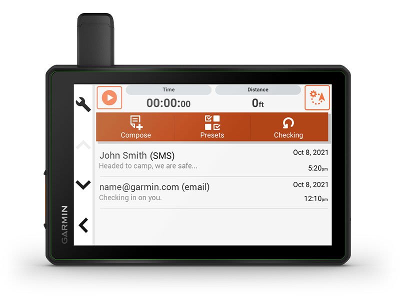
Peace of mind comes built-in. With an active subscription, you can use inReach® technology for global satellite communication.
General |
|
| Dimension | 8.1"W x 6.7"H x 1.2"D (20.7 x 16.9 x 3.1 cm) |
| Weight |
22.8 oz (646 g) |
| Waterproof | IPX7 |
| Display Type | multi-touch, glass, high brightness HD color TFT with white backlight |
| Display Size | 6.8"W x 4.2"H (10.8 cm x 17.2 mm); 8" diagonal (20.3 cm) |
| Display resolution | 1280 x 800 pixels |
| Dual-orientation display | ● |
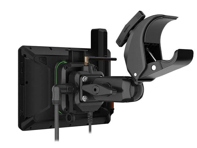
| Magnetic Mount | locking magnet-assisted mount |
| Tube mount (1.5" - 2.375") | ● |
| 1.5" ball adapter with AMPS plate | ● |
| Drop rating | MIL-STD-810 |
| Dust rating | IP6X |
| Battery type | rechargeable lithium-ion |
| Battery life |
Up to 6 hours at 50% backlight |
Maps & Memory |
|
| Preloaded street maps | ● |
| High Definition 3D terrain | ● |
| Data cards | microSD? card (not included) |
| 3D Terrain | ● |
| Internal storage | 64 GB |
| Ability to add maps | ● |
| External memory storage | yes (256 GB max microSD? card) |
| Includes map updates | ● |
| Downloadable Satellite Imagery | yes (BirdsEye) |
| BirdsEye Direct Satellite Imagery | ● |
| TOPO map support | ● |
Sensors |
|
| GPS | ● |
| Galileo | ● |
| Barometric altimeter | ● |
| Compass | ● |
| 10 Hz multi-GNSS positioning | ● |
Outdoor Recreation |
|
| Point-to-point navigation | ● |
| Preloaded topographical maps | ● |
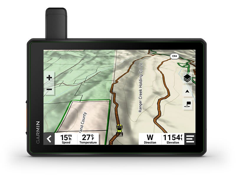
| Preloaded US public land boundaries | ● |
| Preloaded private land parcel maps | yes (parcels greater than 4 acres) |
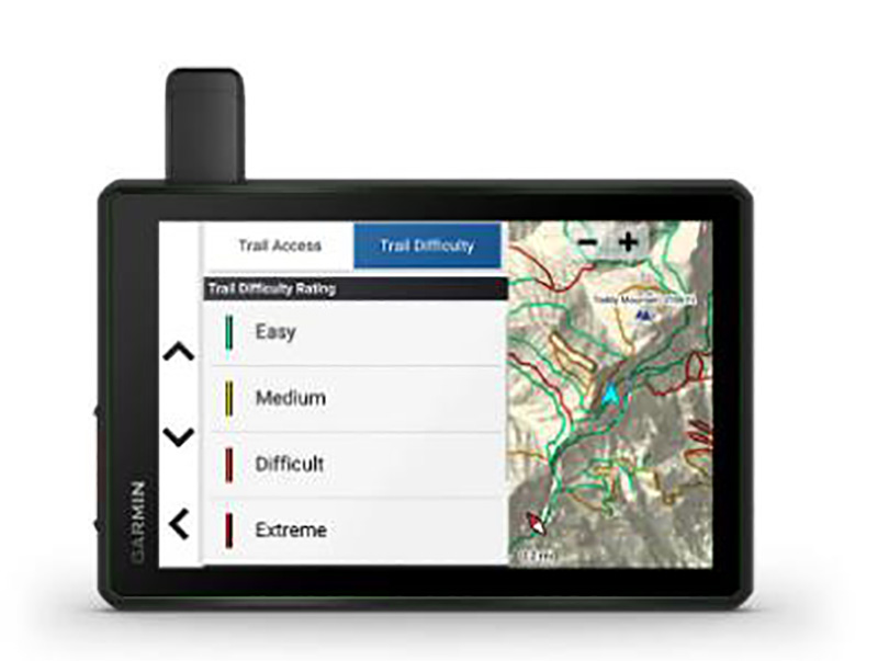
| Preloaded USFS Roads and Trails, including motor-vehicle-use-maps for motorcycle, ATV, SXS and full-size 4x4 | ● |
| Navigate-a-track navigation | ● |
| Turn-by-turn trail navigation | ● |
Camera Features |
|
| Backup camera compatible | yes (BC? 50 only) |
Navigation Features |
|
| Garmin Real Directions? landmark guidance | ● |
| TripAdvisor® Traveler Ratings | ● |
| Route shaping through preferred cities/streets | ● |
| Includes traffic | yes (with Garmin Tread app) |
| Lane assist with junction view (displays junction signs) | ● |
| BLUETOOTH® pairing | yes (works with BLUETOOTH-compatible helmet, headset or smartphone; BLE capable) |
| Speed limit indicator (displays speed limit for most major roads in the U.S. and Europe) | ● |
Advanced Features |
|
| Smart notifications via app | ● |
| Wi-Fi® map and software updates | ● |
| Access to live services via app (traffic, weather, etc.) | ● |
Motorcycle Features |
|
| Control music and media from smartphone or MP3 player | ● |
| Sunlight readable and weather resistant | ● |
| Garmin Adventurous Routing? | ● |
| Motorcycle or powersports specific points of interest for cycle repair services, dealers and more | ● |
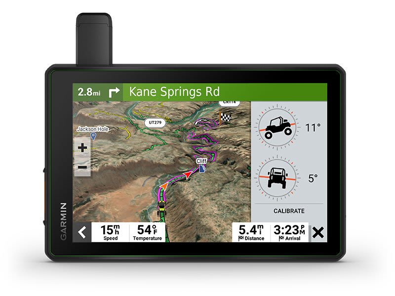
| Elevation profile | ● |
| Round trip routing | ● |
| Service History Log | ● |
| Custom map support | ● |
RV Features |
|
| Specialized routing for the size and weight of your vehicle | ● |
| RV Parks & Services directory | ● |
| Road elevations | ● |
| Speed limit changes | ● |
| Easy Route Planner with GPX file sharing | ● |
Adventure Features |
|
| Built-in inReach® Technology (requires active subscription; subject to regulations or prohibitions in some jurisdictions) | ● |
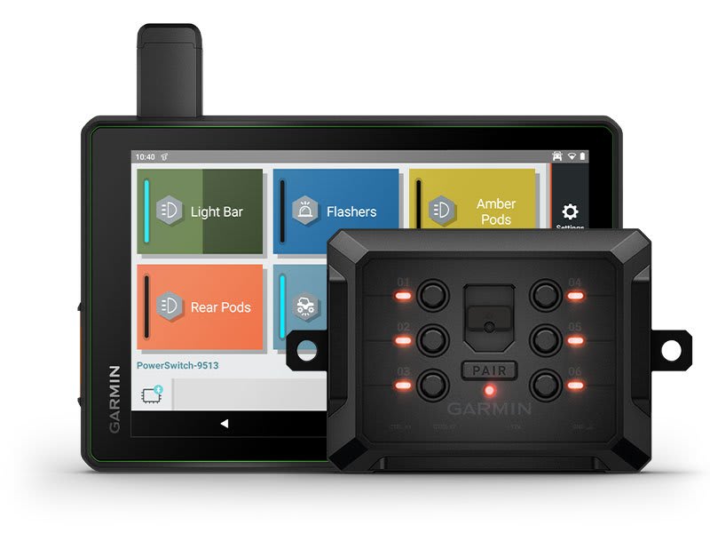
| Pair with Garmin PowerSwitch? digital switch box | ● |
| Compatible with Group Ride Radio | yes (included) |
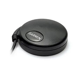
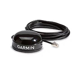
| Compatible with external GPS antenna with mount | ● |
| Compatible with external inReach® satellite antenna | ● |
| Group Ride Mobile | yes (with Garmin Tread app) |
| Track recorder (breadcrumbs) | ● |
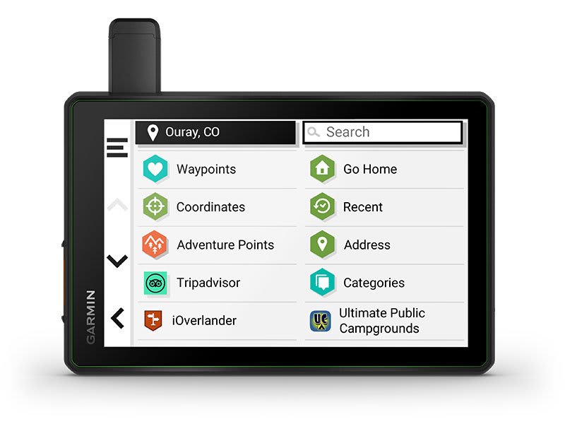
| iOverlander? points of interest | ● |
| Ultimate Public Campgrounds | ● |
| Pitch and Roll gauges | ● |
| Birdseye Satellite Imagery (download via Wi-Fi) | ● |
| Glove-friendly touchscreen | ● |
Group Ride Radio |
|
| Radio Frequency Band | MURS (151-154 MHz) |
| Group Ride Range | typically 1 mile |
| Group Ride tracking | up to 20 riders simultaneously |
| Group Ride update rate | 2.5 seconds |
| Group Ride voice communications | yes (with included fist mic or paired BLUETOOTH headset) |
| Fist mic compatibility | Also works with other MURS VHF radios (151 MHz - 154 MHz) |
| Radio transmitted canned messages | ● |
Outdoor Applications |
|
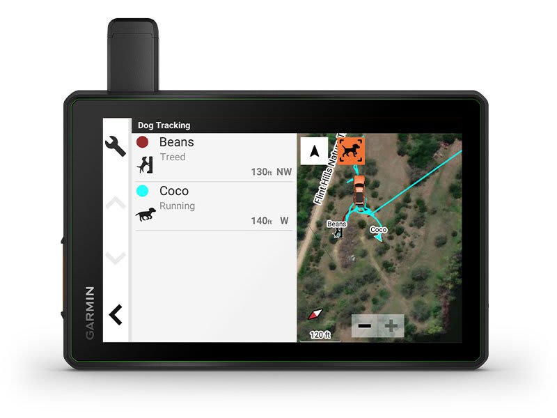
| Dog tracking | ● |
Security Information |
|
| Security updates until at least (YYYY-MM-DD) | 2023-12-22 |
Customer Service QQ
Customer Hotline:
Technical Supports


 3003988120
 yiqi.com
 bio-equip.com
 b2bwork.baidu.com
 baidu.com